No products in the cart.
E – 1619 Horizontal Control Survey Techniques
$75.00
Courses Included
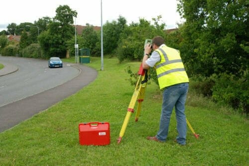
This course discusses horizontal control surveys that are performed to establish a monumented reference system for a facility mapping project. These fixed horizontal control points and vertical benchmarks are then used as starting points for supplemental topographic site plan mapping.. Horizontal positions of permanent monuments around a facility or project site can be established by a number of survey techniques. These include traditional traverse, triangulation, or trilateration surveys from an established geodetic network on an installation or region (e.g., NSRS). Alternatively, GPS methods can be performed to extend control from an established network to the project site. Since most modern day survey crews or firms possess both GPS and total station equipment, there would be little justification for running lengthy (and costly) traverses or triangulation/trilateration networks to bring in control to a local site. Therefore, this discussion will focus on current practices for performing “traditional” horizontal control surveys–i.e. control being established using total station traverse methods. (This discussion does contain some background on older survey methods for use in basic surveying courses). Triangulation and trilateration methods will only be briefly addressed.
Course Outline
1. INTRODUCTION
2. TRADITIONAL HORIZONTAL CONTROL SURVEY TECHNIQUES
3. SECONDARY OR TEMPORARY HORIZONTAL CONTROL
4. BEARING AND AZIMUTH DETERMINATION
5. ELECTRONIC DISTANCE MEASUREMENT
6. COORDINATE COMPUTATIONS
7. TRAVERSE SURVEYS
8. TRAVERSE SURVEY GUIDELINES
9. TRAVERSE COMPUTATIONS AND ADJUSTMENTS
10. TRAVERSE ADJUSTMENT (COMPASS RULE)
11. TRIANGULATION AND TRILATERATION SURVEYS
This course will give professional engineers and land surveyors a better understanding of horizontal control land survey methods and techniques.
Description
This course discusses horizontal control surveys that are performed to establish a monumented reference system for a facility mapping project. These fixed horizontal control points and vertical benchmarks are then used as starting points for supplemental topographic site plan mapping.. Horizontal positions of permanent monuments around a facility or project site can be established by a number of survey techniques. These include traditional traverse, triangulation, or trilateration surveys from an established geodetic network on an installation or region (e.g., NSRS). Alternatively, GPS methods can be performed to extend control from an established network to the project site. Since most modern day survey crews or firms possess both GPS and total station equipment, there would be little justification for running lengthy (and costly) traverses or triangulation/trilateration networks to bring in control to a local site. Therefore, this discussion will focus on current practices for performing “traditional” horizontal control surveys–i.e. control being established using total station traverse methods. (This discussion does contain some background on older survey methods for use in basic surveying courses). Triangulation and trilateration methods will only be briefly addressed.
Course Outline
1. INTRODUCTION
2. TRADITIONAL HORIZONTAL CONTROL SURVEY TECHNIQUES
3. SECONDARY OR TEMPORARY HORIZONTAL CONTROL
4. BEARING AND AZIMUTH DETERMINATION
5. ELECTRONIC DISTANCE MEASUREMENT
6. COORDINATE COMPUTATIONS
7. TRAVERSE SURVEYS
8. TRAVERSE SURVEY GUIDELINES
9. TRAVERSE COMPUTATIONS AND ADJUSTMENTS
10. TRAVERSE ADJUSTMENT (COMPASS RULE)
11. TRIANGULATION AND TRILATERATION SURVEYS
This course will give professional engineers and land surveyors a better understanding of horizontal control land survey methods and techniques.
- Learn about horizontal control survey methods;
- Find out about minimum instrument requirements for the establishment of primary control;
- Learn when primary project horizontal control points not permanently monumented in accordance with appropriate criteria and guidance should meet certain minimum standards:;
- Learn when redundancy techniques are called for;
- Learn about repeating and directional theodolites; and
- Learn the importance of station calibration.

